From a million questions we can ask in a lifetime,
only a few would lead us to pursue answers.
And only so many dare to take on those daring journeys.
But for those who are foolish enough,
a million years wouldn't be enough to chase
those daring things that we call "truth"
- Hanggara, 2024
ONE
The Illusion of Map
I woke up in the silence of 3 am, staring at the ceiling, gripped by one of these questions. As a documentary filmmaker and an expeditioner, my life is spent capturing the world. But in the quiet of the night, when the frantic noise of our modern achievement society finally pauses, I am forced to be a philosopher. The question that haunted me was simple, yet it unravels my deep concerns over the years as a photographer and filmmaker:
Why do we map a forest? Or, more precisely, why do we feel the need to represent reality at all?
Let me explain this to you as you drink your morning coffee. It sounds complex at first. We will talk about global carbon markets, Martin Heidegger’s phenomenology, and the philosophy of time. Already weird enough? But I promise you, it is actually about what it means to be a human being trying to survive on this earth.
In September 2022, I found myself thrown—what Heidegger would call Geworfenheit—into the deep, humid peat swamp forests of Central Kalimantan. I was navigating the Kahayan landscape as a Field Researcher for Bioeconomy Singapore. My task was to conduct participatory mapping and social baselines for the Kahayan Conservation Project (KCP), meticulously aligning the conservation efforts with the rigorous global standards of High Conservation Value (HCV) and Climate, Community & Biodiversity (CCB). But what are these standards, really, when you strip away the corporate vernacular?
From the perspective of our late-modern world, they are the ultimate manifestation of a society obsessed with calculation. We attempt to offset the violent, accelerating machinery of industrial capitalism by creating an equally systematic, calculated machinery of conservation. We turn the breathing earth into a spreadsheet of carbon sinks, emission reductions, and sustainable yields. When we do this, we are treating the forest merely as something present-at-hand (dihadirkan)—an object to be stared at, measured, and optimized. We forget that for the people living there, the forest is ready-to-hand (difungsikan)—the very fabric of their being in the world.

15 September. To reach the villages, we rely on the primary artery of Kalimantan’s deep interior: the klotok boat. Photo by Hanggara Tala
When a satellite looks down at the Kahayan landscape to measure carbon density, it operates in what we might call point-time. A satellite sees only a flat, timeless positivity. It creates a reproduction of the Earth. But fundamental reality is non-reproducible, and a map drawn by a satellite does not breathe. It does not bleed. It knows nothing of the weight of the wood carried on a man's back.
But when you are standing knee-deep in the peat swamps of Kahayan, you realize that reality possesses a friction that eludes all calculation. I see our modernity's weakness. We create a perfect schedule, military precision, zero flexibility—then reality hits, and we fail, and we quit because we think we're not disciplined and scientific enough. Perhaps we're not water enough to perceive that rigid plans always fail against reality.
We could not rely on the view from above. Our mandate required us to enter the forest, to move through the districts of Rakumpit and Bukit Batu, traversing rivers by klotok and forcing our way through dense, unforgiving thickets on motorcycles.
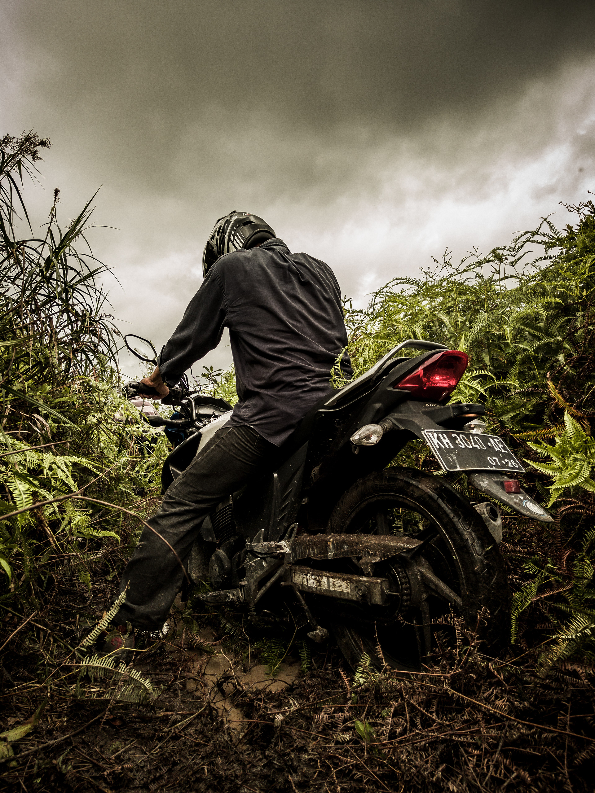
Mapping community land claims. When the roads end, you force your way through the brush. Photo by Hanggara Tala
Out here, the illusion of point-time collapses entirely. Conducting participatory mapping with the local communities is not an exercise in geography. Every time we draw a line on a map, or every time I press the shutter on my camera to take a photograph, I am creating a memorial. We do this because we are terrified of the tearing away of time. A photograph or a map is an act of memoria—an intentional effort to take a reality that "has-been" (sudah-terjadi) and drag it into the future. We photograph, and we map it because we intuitively know that time is slipping through our fingers. We want to freeze the impermanent. We want to believe that the label we place on the forest will save it.
But a name can't fully describe it, and label wouldn't tie people.
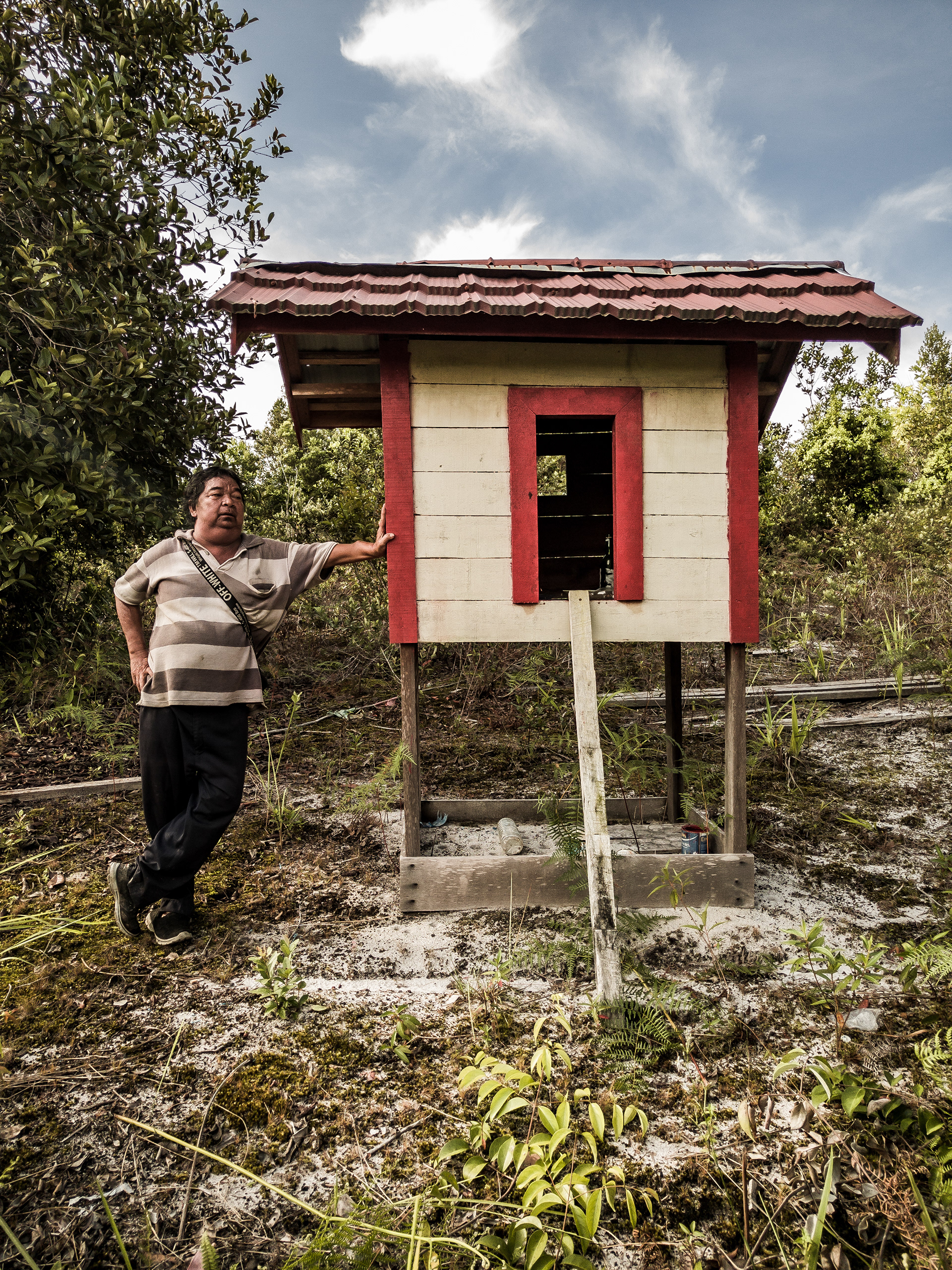
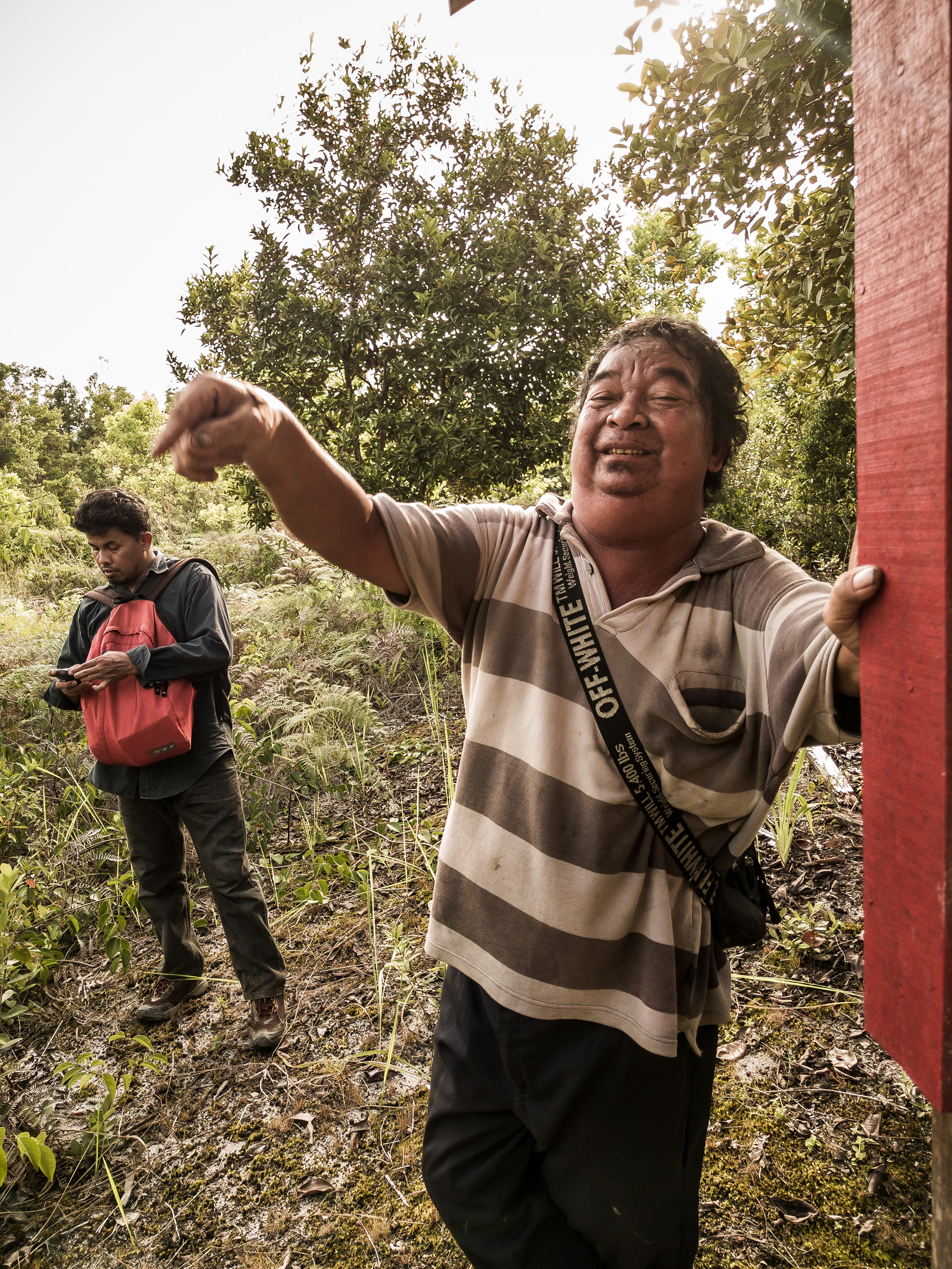
The abstraction of the map is entirely insufficient for the reality of the soil. During this expedition, I learned that storytelling, much like field research, is an act of surrendering to the reality of the field. You cannot impose a rigid, pre-fabricated narrative upon a landscape that has endured centuries of shifting powers. Because what’s a life without the abstraction of narrative to give its true meaning?
To truly understand this place, you must linger. You must develop a vita contemplativa—a long, slow gaze that goes easy on things, letting them be in their own space and radiance.
In our modern achievement society, multitasking and the rapid shifting of attention are celebrated as progress, but they are, in fact, a regression to the vigilance of wild animals. When we rush into a forest to extract data, to extract carbon credits, we act with the same panicked haste. We do not look. We do not listen. But out in the Kahayan peatlands, the environment forces you to slow down. It forces you to taste the earth.
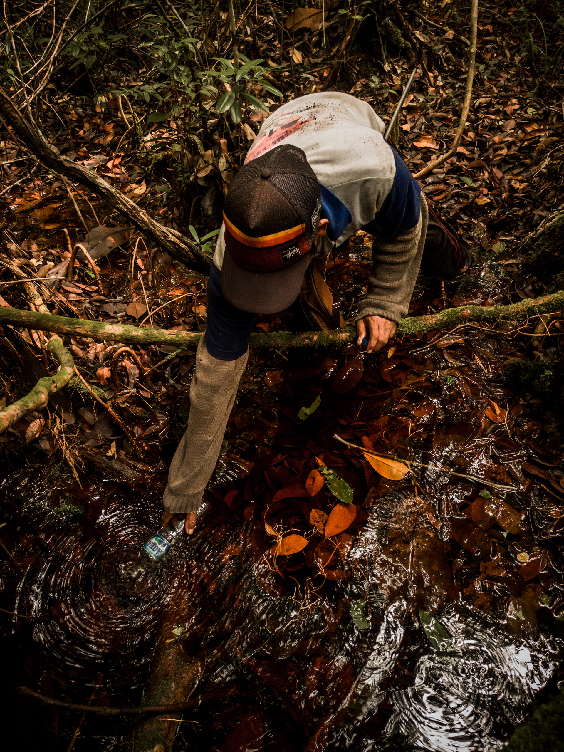
Drinking the swamp water. Photo by Hanggara Tala
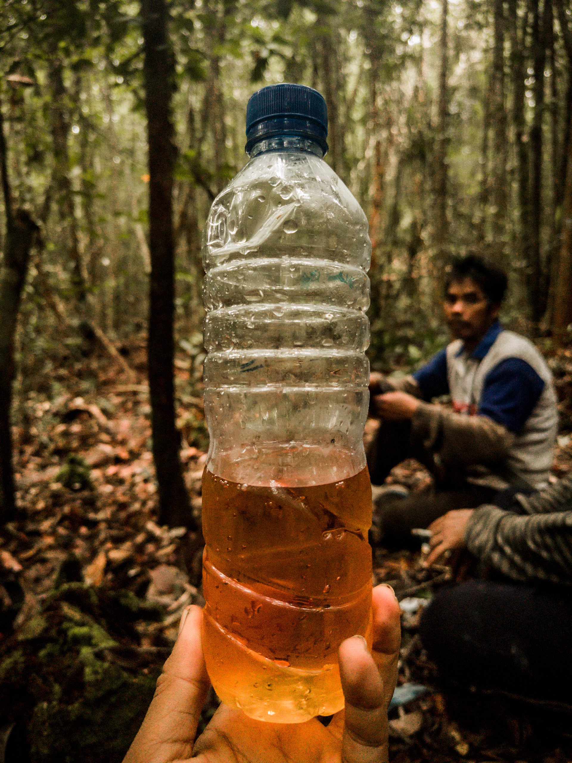
"Oh beloved earth water. It's been five years since we last met." Photo by Hanggara Tala
To drink the brownish, peat-filtered water of the swamp is to consume the duration of the forest. It is a stark reminder that survival is not living means to be, it just what it is to be. This water has a scent, a taste steeped in the slow decay and regeneration of the ecosystem. It is the fragrant crystal of time, compressed into a liquid form.
We cannot solve the ecological and social crises of our time through the same frantic, calculating mindset that created them. We arrive in these remote villages armed with CCB standards and Free, Prior, and Informed Consent (FPIC) protocols, treating them as bureaucratic checklists. But FPIC is not a signature on a form. It is the slow, painstaking process of proving to a community that you will not break their hearts again.
In the next part of this essay, we will dive deeply into the specific realities of the villages we mapped—from the sacred shrines in Sei Gohong to the brutal, heartbreaking economics of the logging camps in Pager. We will examine how the "violence of positivity" manifests in the daily lives of those who live on the edges of our global conservation goals. Because before we can propose solutions, we must first have the courage to look at the world exactly as it is. We must learn to be formless, to flow into the crevices of human suffering and ecological majesty alike.
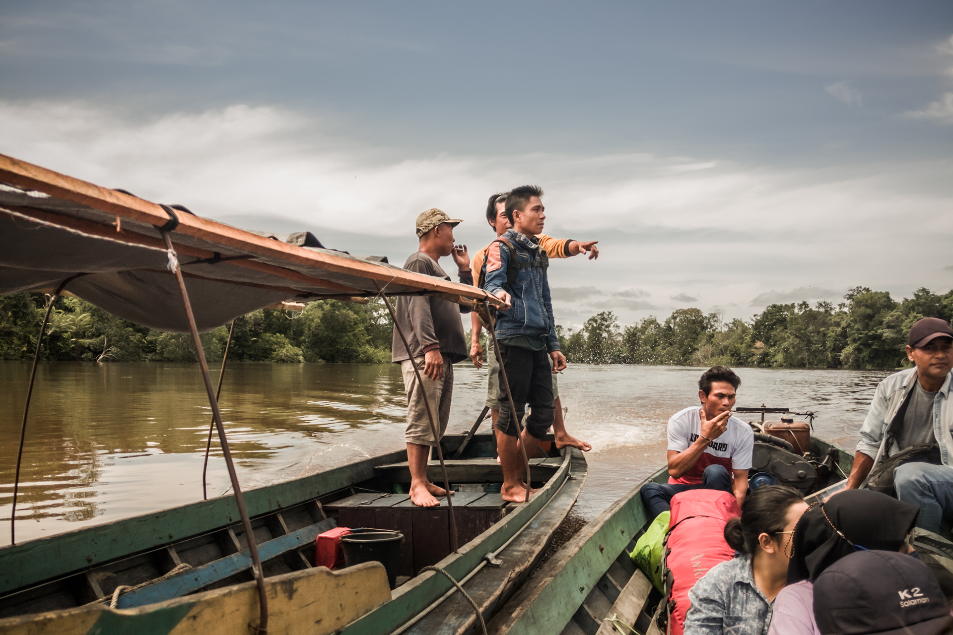
The klotok used by the study team to move from one village to another, to reach all eleven villages and collect data in 25 days of fieldwork. Photo by Hanggara Tala
TWO
Topology of Peatland and Animal Laboran
We must begin by walking. When thinking about time, to leave the corporate offices of our modern world and step into the peat swamps of Central Kalimantan is not merely a change of geography—it's a violent shift in ontology. In the city, time whizzes by in a hyperactive blur—a continuous present where everything is a project, a deadline, a carbon calculation. But the forest does not whizz. The forest lingers. It has its own natural oscillation, an intrinsic slowness that our age of haste has entirely forgotten.
When we began the participatory mapping for the Kahayan Conservation Project (KCP) with Bioeconomy Singapore in September 2022, we were tasked with delineating High Conservation Value (HCV) and Climate, Community & Biodiversity (CCB) boundaries.
But how do you draw a boundary around a memory?
As I pushed my motorcycle through the dense, unforgiving brush toward the villages, I realized that modern conservation often treats the forest as something merely dihadirkan—an object to be stared at, measured by satellites, and optimized for global carbon markets. But to the people who live there, the forest is difungsikan. It is the very fabric of their being in the world. You cannot impose the point-time of a satellite onto a landscape steeped in the duration of generations.
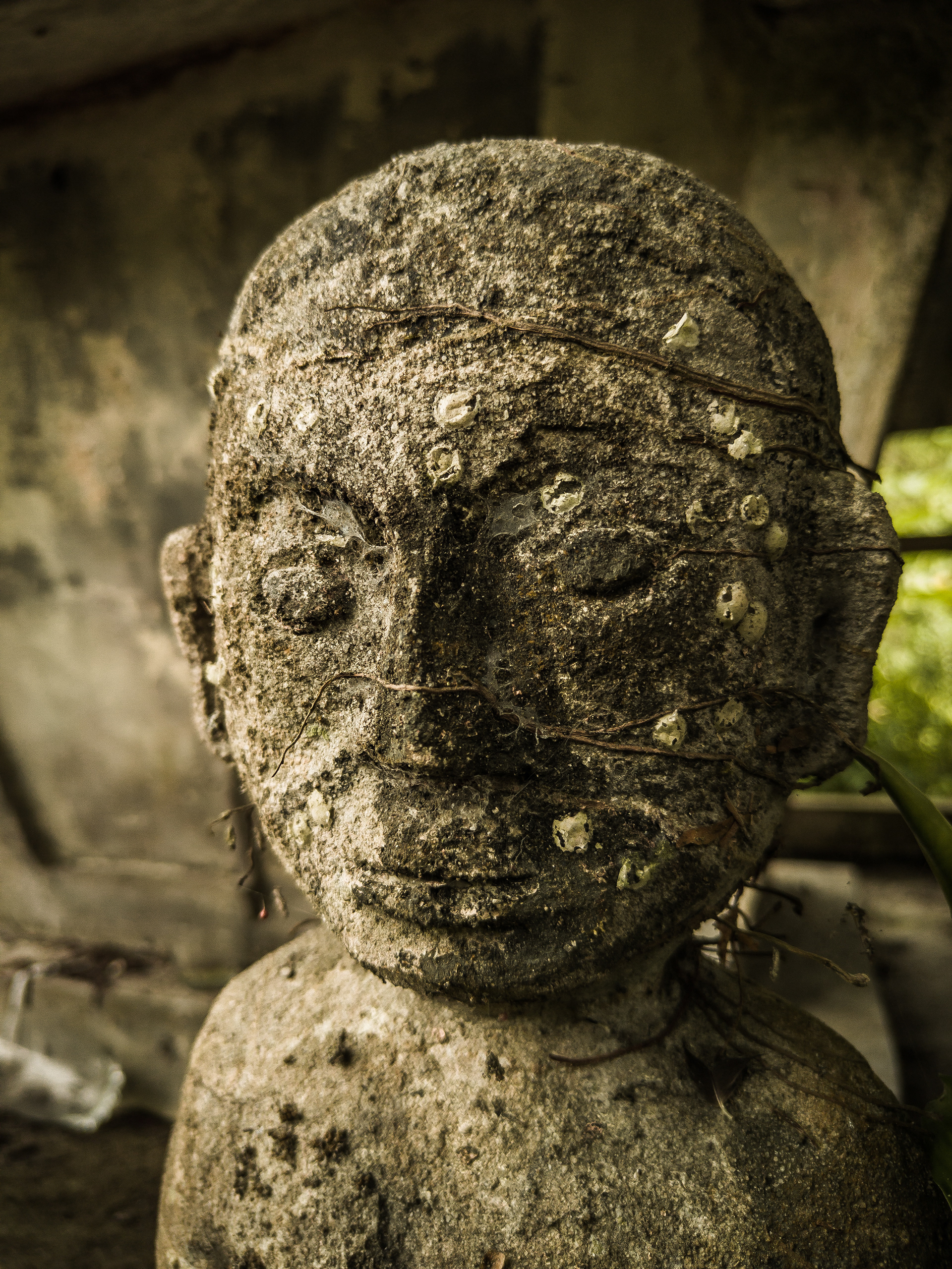
Sandung—an ancestral bone shrine. Photo by Hanggara Tala
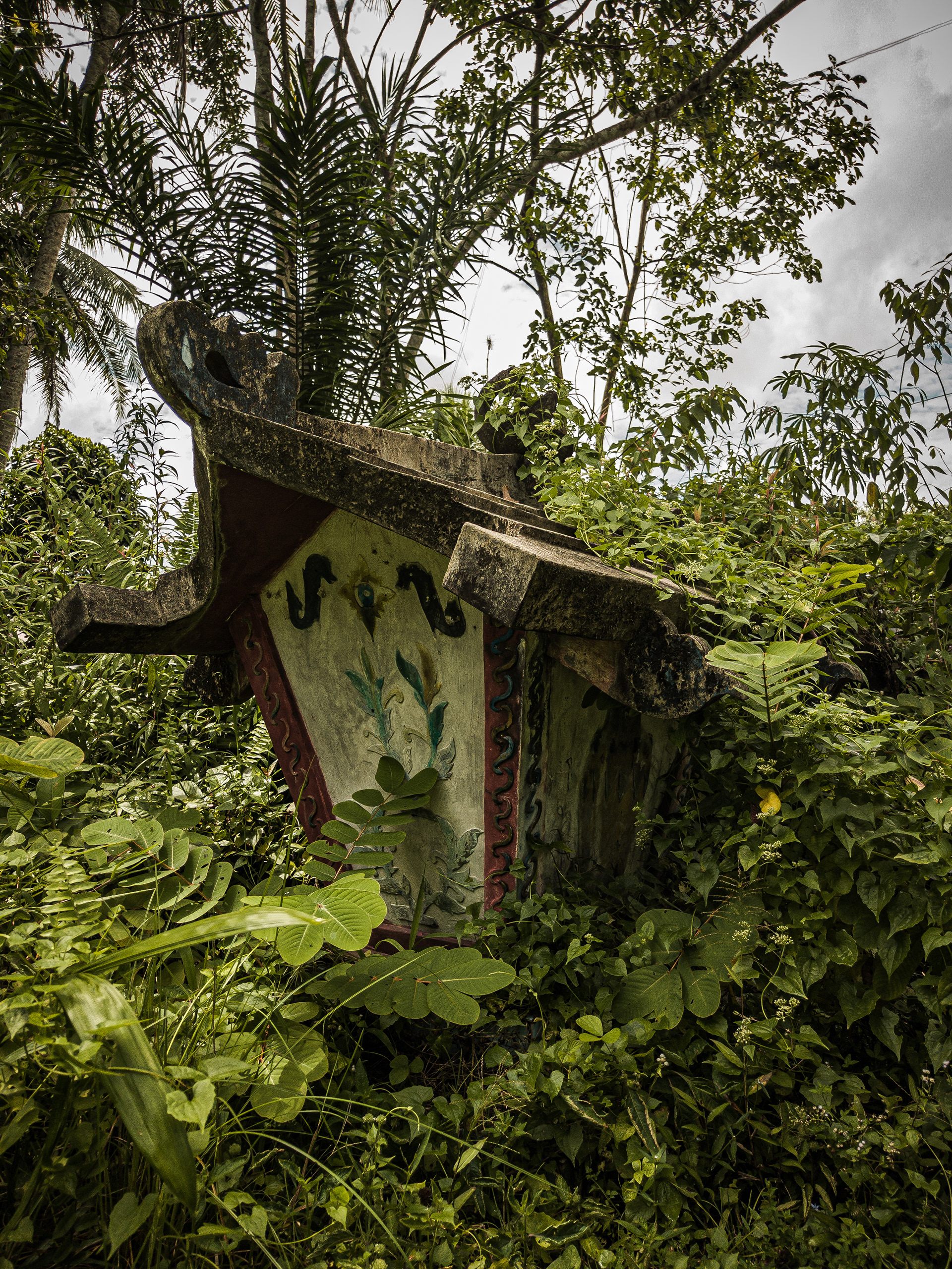
Pasah Patahu—small structures believed to house the guardian spirits of the village. Photo by Hanggara Tala
When assessing High Conservation Value, particularly HCV 5 (basic community needs) and HCV 6 (cultural significance), the data is rarely found in government archives. It is found in the memories of the elders. In the villages of Sei Gohong and Kanarakan, our participatory mapping exercises revealed a landscape layered with invisible, sacred boundaries.
We mapped the Sandung—ancestral bone shrines scattered along the village paths, holding the remains of family lineages. We documented the Pasah Patahu—small structures believed to house the guardian spirits of the village. When a community draws these shrines on a map, they are engaging in an act of memoria—an intentional effort to take a reality that has-been and drag it into the future. They are anchoring their existence against the tearing away of time.
But the forest is also a space of intense human friction. In Sei Gohong, we encountered overlapping land claims, a bitter dispute between the Puduk Bendera Farmer's Group and the Dahlia Farmer's Group from neighboring Kanarakan over 180 hectares of land. This conflict was rooted in the traditional concept of Ayunku—a system of claiming land by physically blazing a trail or placing markers through the brush.
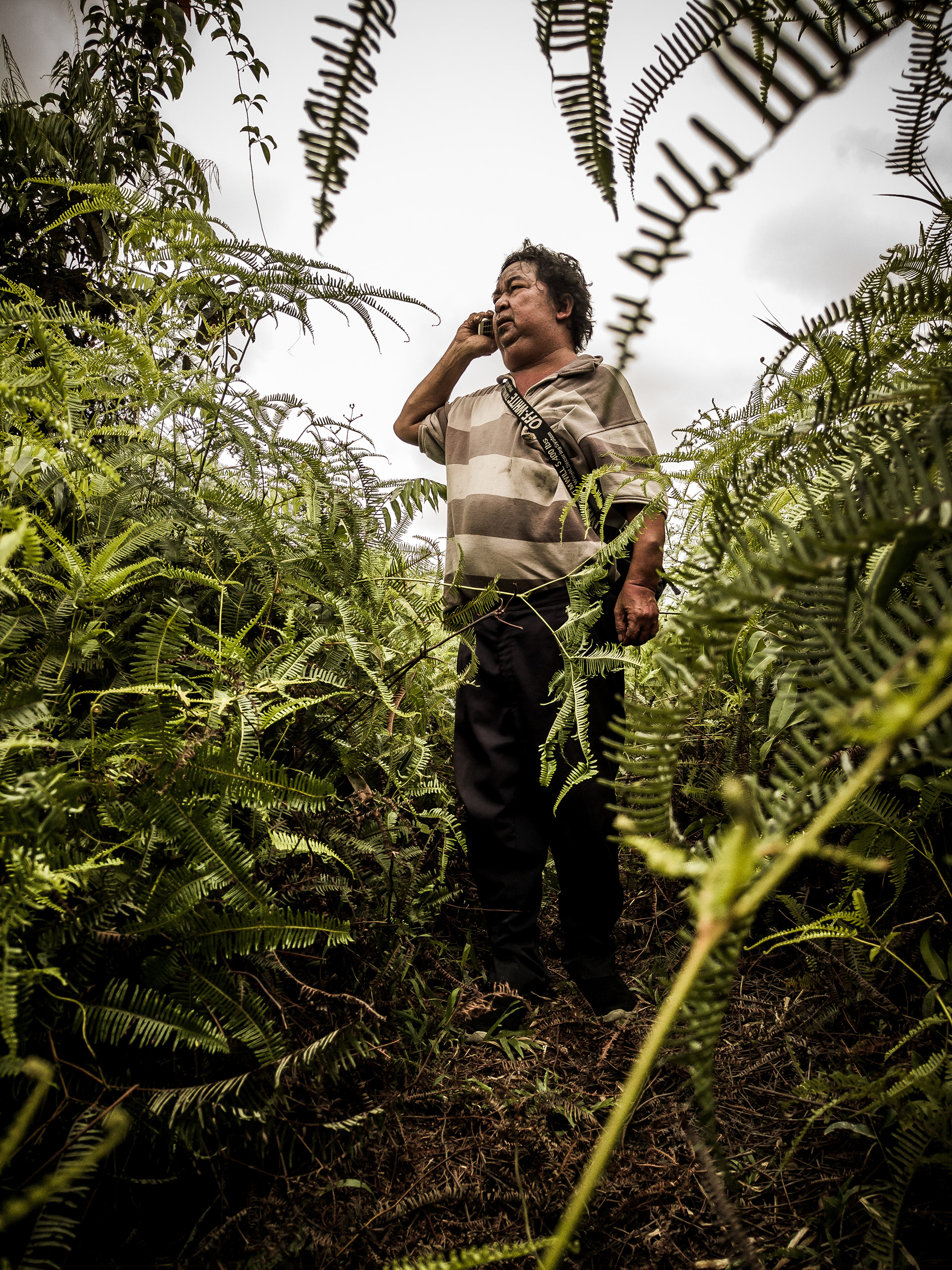
Ayunku—a traditional system of claiming land by simply blazing a trail through the brush. Photo by Hanggara Tala
Ayunku is the physical manifestation of claiming space through labor. It is a reminder that for the people that living on it, the environment is not just a pristine and empty museum. It's also a contested arena of survival.
Applying Free, Prior, and Informed Consent (FPIC) in these conditions cannot be a mere bureaucratic checklist. It requires a profound releasement (Gelassenheit) from our own agendas. Because a rigid plans will fail against reality, we had to flow between these opposing truths, understanding that intuition can only function in authentic environments, and real perception only exists where life is allowed to be imperfect.
As we moved deeper into the Kahayan landscape, the abstraction of carbon stocks dissolved entirely into the tactile reality of the earth. We frequently encountered the towering Red Belawan trees. Growing 10 to 20 meters high with a diameter of 40 to 60 centimeters, the Belawan commands attention with its striking, reddish-brown bark that naturally cracks and peels away.
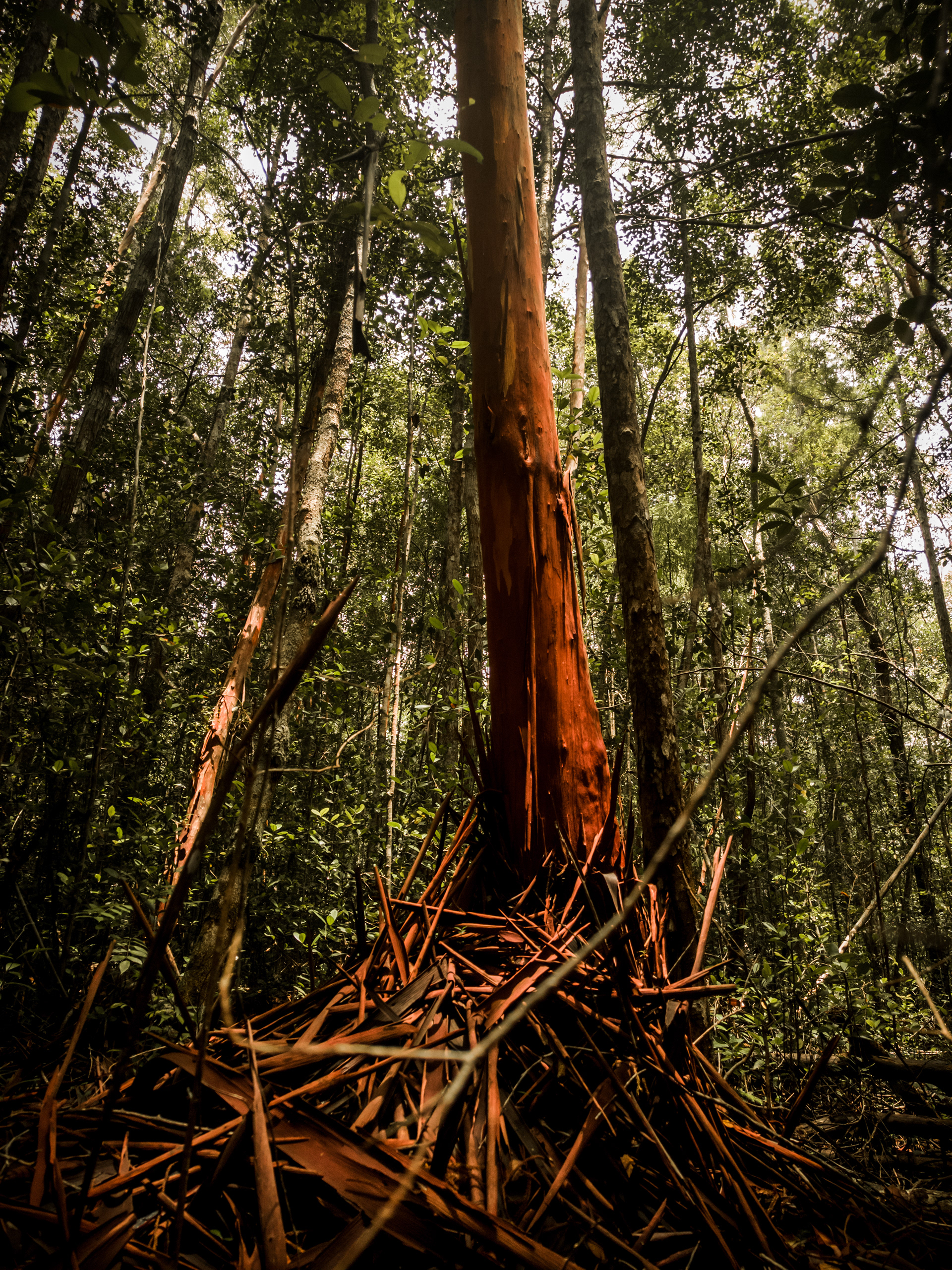
The Red "Belawan" Tree. Its reddish-brown bark naturally peels and sheds, a characteristic it shares with the guava family. Photo by Hanggara Tala
But to the local communities, its beauty is entirely utilitarian. This is the primary wood used to build the support pillars of their homes, their workshops, and the floating lanting rafts that line the rivers.
The Belawan tree does not rush. It has its own natural oscillation. When a global carbon project dictates that a forest must be strictly conserved, it is essentially asking a community to stop harvesting the very pillars that hold up their roofs.
In our contemporary achievement society, we believe we can solve ecological crises purely through calculation and restriction. But thinking that entirely lacks any circuitous character degenerates into calculating. And to conserve the Belawan tree requires us to first understand the profound weight of the wood these people carry on their backs.
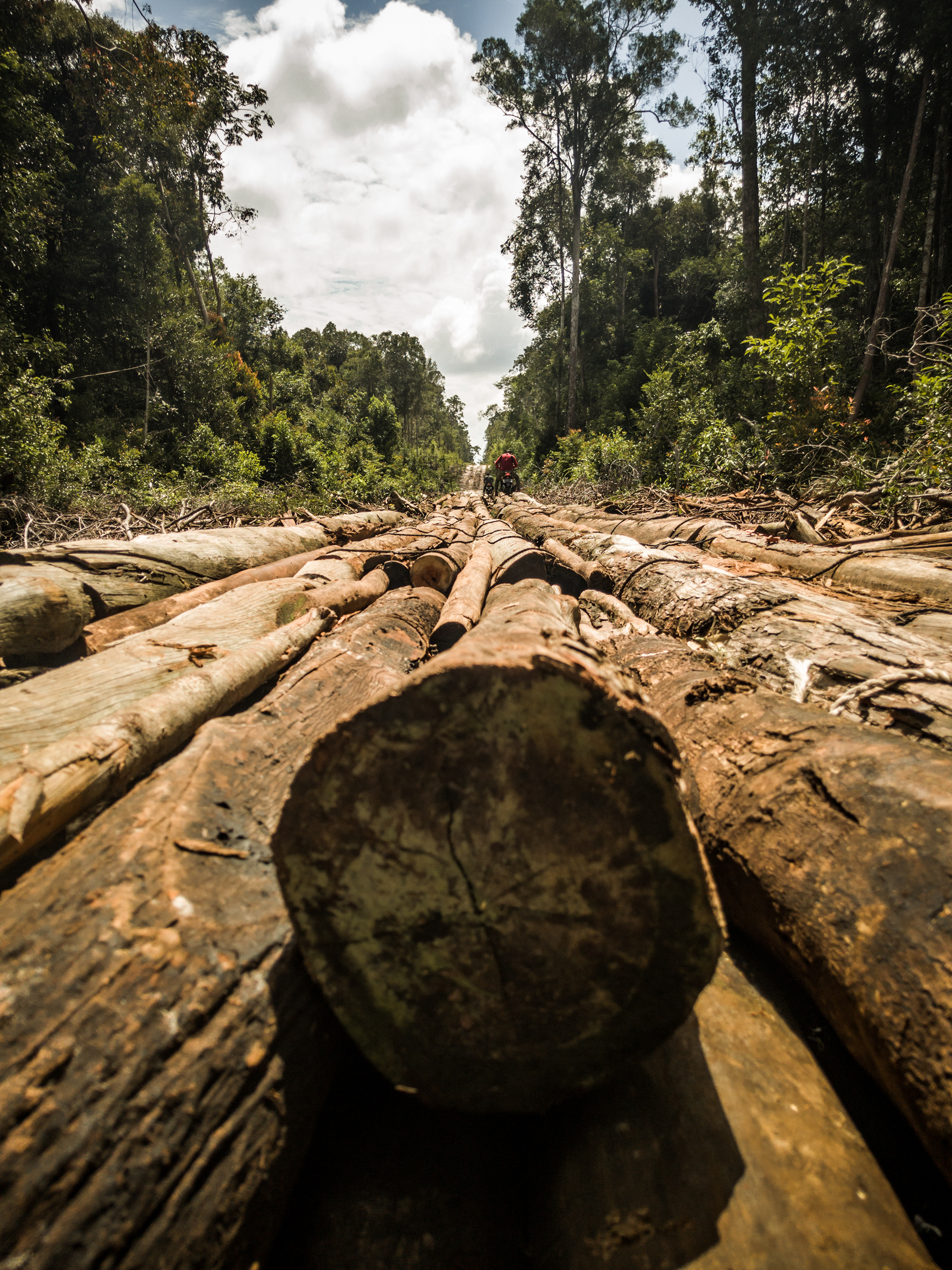
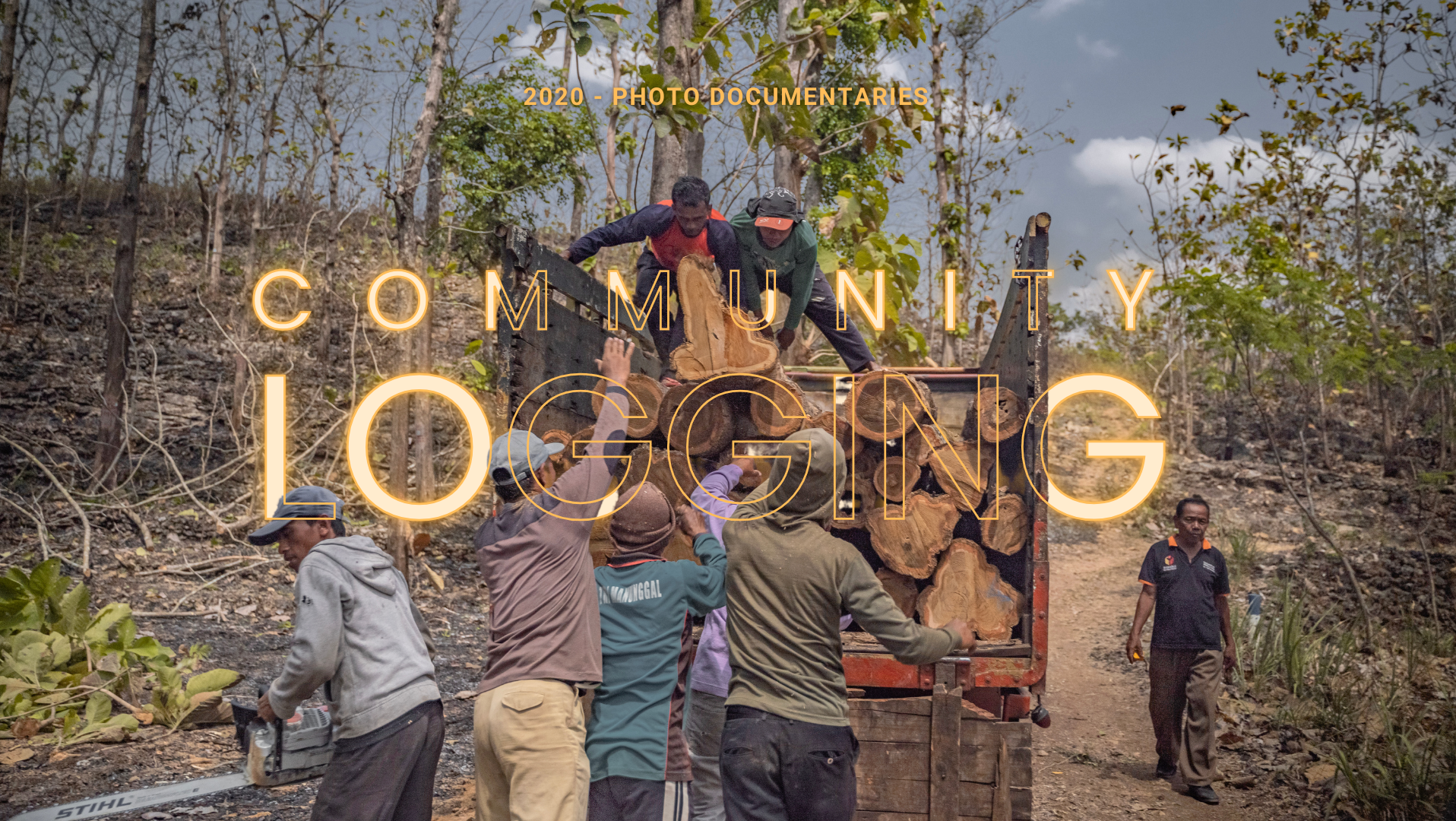
"Why? Because what we are looking for this time isn't a customary forest... but a community logging area". Photo by Hanggara Tala
If the maps of Sei Gohong were a cartography of memory, the reality we found in the villages of Pager and Bukit Sua was a cartography of exhaustion. Here, the pristine image of global conservation collided violently with the brutal economics of rural Indonesia.
How do you convince a community to leave the forest untouched when the market price of rubber plummets to a dismal Rp 6,000 per kilogram? You don't. Instead, you watch the community adapt to survive. In Pager, just four kilometers inside the LBP concession boundary along Jalan Bakung, we documented extensive community logging operations.
We found the pondokan—makeshift logging camps built deep in the forest, suspended over the dark river. Men slept here, six days a week, surrounded by mosquitoes, to cut Meranti and Rasak wood. The wood was hauled out on modified vehicles over ruined, muddy trails and hundreds of makeshift wooden bridges.

Pondokan—a place where men rest their bodies, unable to return to the village while hauling wood for the week. Life is unfair, but out here, the weight is heavy. Photo by Hanggara Tala
The men did this back-breaking labor just to afford basic survival, earning around Rp 800,000 to Rp 900,000 per cubic meter of Meranti, or hauling Rasak wood for a week to earn Rp 500,000 per truckload. They did this because, as one informant told us, the alternative—mining for zircon in the rivers—was too heavy, unpredictable, and nomadic.
In his philosophy, Byung-Chul Han notes that the modern subject deems itself free, but is actually bound like Prometheus, constantly exploiting itself until it burns out. But here in the peat swamps of Pager and Bukit Sua, we see a more primal tragedy. These loggers and zircon miners have been reduced to the ultimate animal laborans—laboring purely to delay death, stripped of the vita contemplativa that makes human life meaningful.
This is the hardest problem of consciousness in the conservation space. The CCB standard dictates that climate projects must alleviate poverty and foster sustainable livelihoods. But standing in that pondokan, watching men feed logs through a diesel-powered sawmill, I felt the sharp irony of our global climate goals.
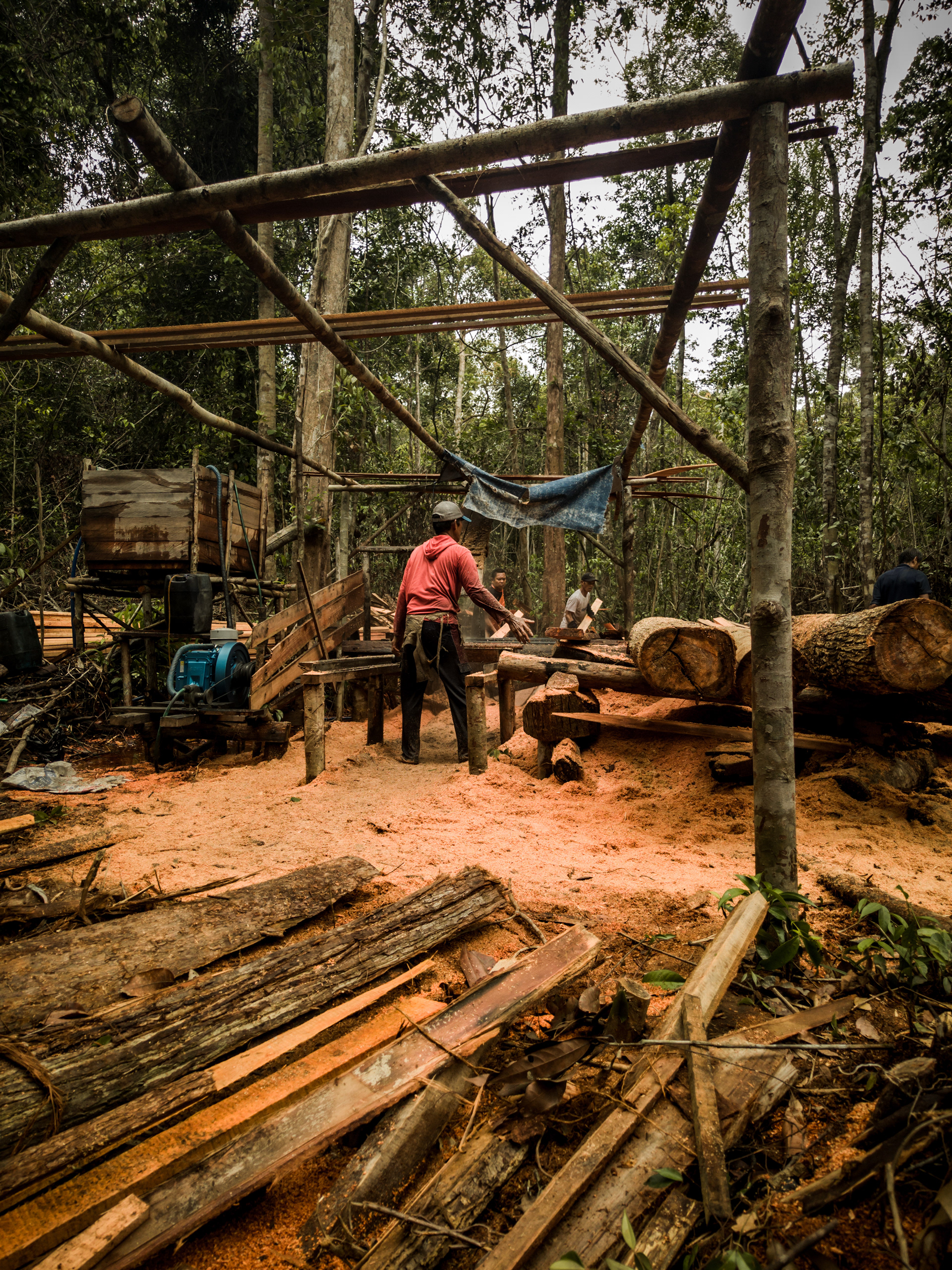
Men feed logs through a diesel-powered sawmill, one of many logging camps that we found inside the conservation boundary. Photo by Hanggara Tala
We treat success like it should cure us, like a carbon credit can hush the scream of what we've seen. But creation and destruction are one and the same. The global market wishes to preserve this ecosystem to offset its own hyperactive industrial destruction, but in doing so, it risks destroying the only livelihood these communities have left.
You do not solve the suffering of the world by simply drawing a protected zone around it on a map. If the global market wants to preserve these forests as carbon sinks, it must provide a viable, dignified alternative for the people who rely on them to eat. We mapped not just the boundaries of the trees, but the boundaries of their desperation.
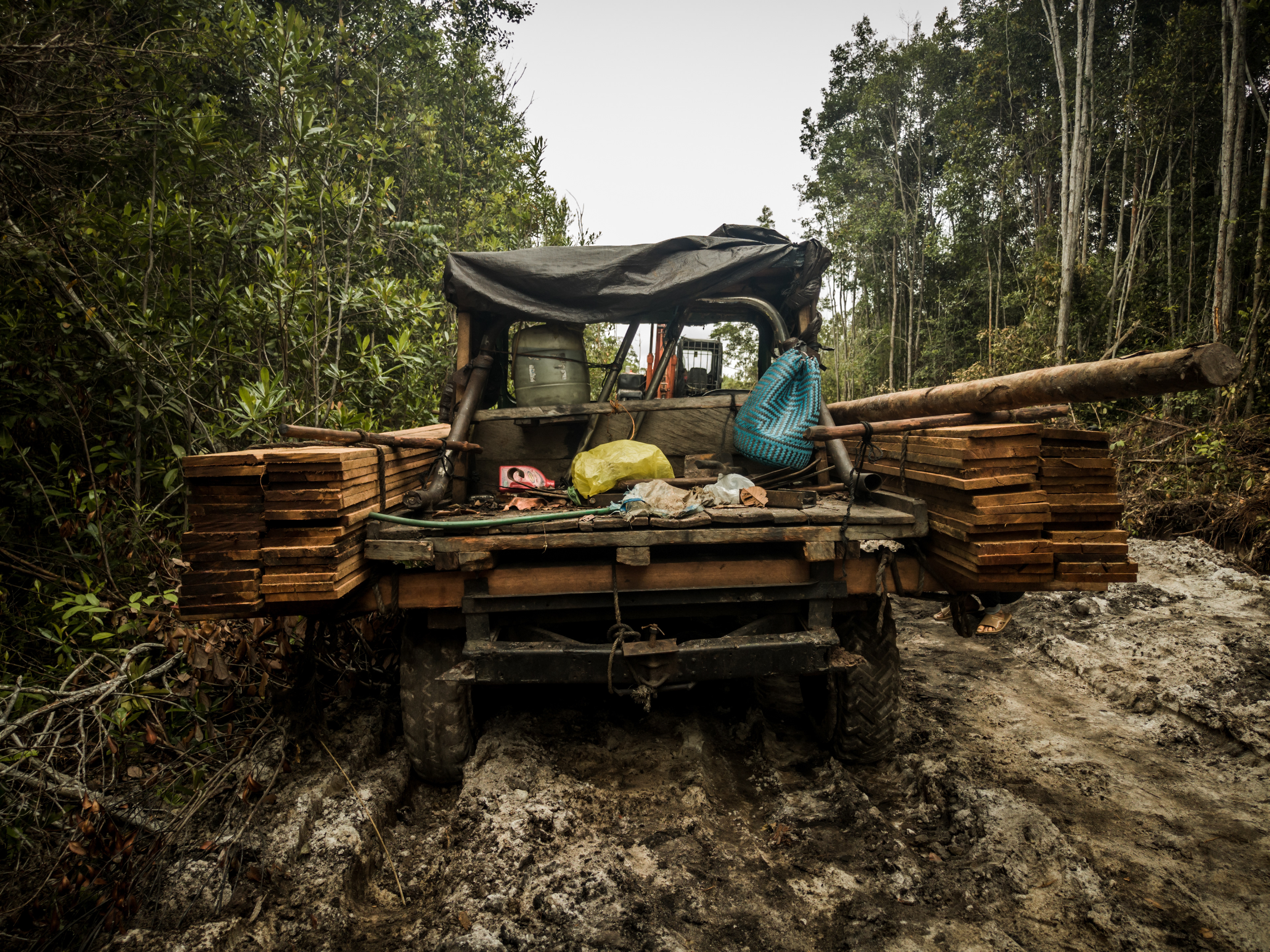
A four-wheeled vehicle modified by loggers to transport logs back to the village. The middle section is used to carry themselves, the cutting machine, and their food supplies. Photo by Hanggara Tala
As we left the grinding, diesel-choked sawmills of the pondokan in Pager behind, we drifted further into the Kahayan landscape. We were moving from a cartography of physical exhaustion into a cartography of psychological scars. If you want to understand a forest, you cannot simply measure its carbon density; you must measure the weight of the shadows cast by its history.
In our hyperactive modern world, we suffer from the delusion that the future is simply a space of endless, optimized possibilities. But out here, in the deep peatlands, the future is often perceived as a threat—a looming repetition of past betrayals.
When we arrived in the village of Panjehang, we did not find a blank slate eagerly awaiting our sustainable conservation project. We found a community carrying the heavy, invisible luggage of trauma. The people of Panjehang are highly cautious and suspicious of any corporate entity entering their territory.
They had already learned the bitter lesson of the achievement society's deceptive positivity. Years earlier, another company, PT. MAPA, had arrived with grand, intoxicating promises of opening up employment opportunities for the locals. It was the classic siren song of modern capital. Yet, those promises never materialized. Instead, the community found themselves faced with restricted access to their own lands, locked out of the very environment that sustained them.
When we sat down on their wooden floors to introduce the Kahayan Conservation Project (KCP) and the Climate, Community & Biodiversity (CCB) standards, they did not see climate mitigation. They saw the ghost of PT. MAPA. They saw another potential land grab disguised in the green, sterile terminology of global sustainability.
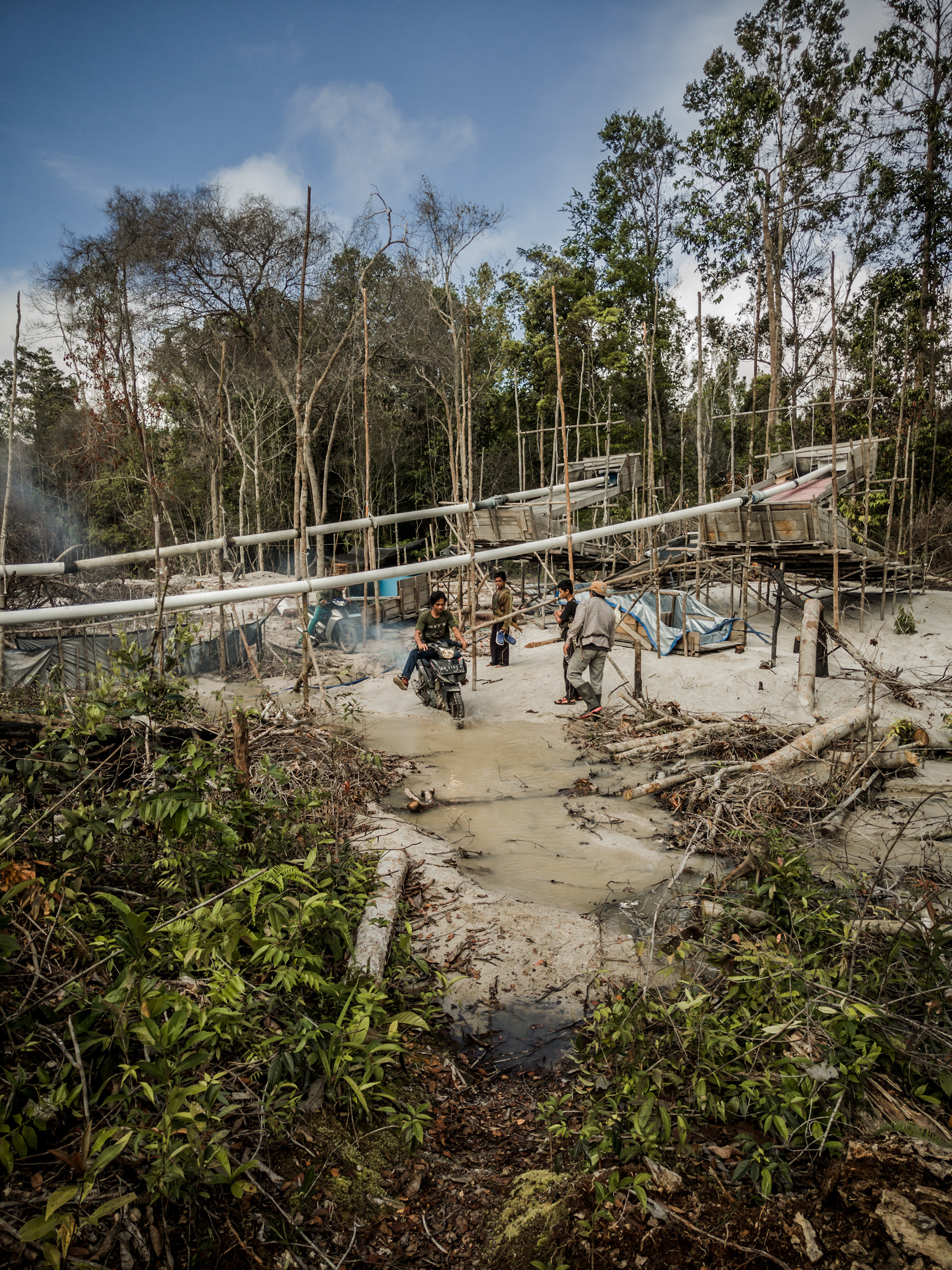
One of the gold extraction areas in Panjehang Village, where the gold extracted from floating rafts—lanting—in the river is filtered using mercury. Photo by Hanggara Tala
Here, the philosophical problem of Free, Prior, and Informed Consent (FPIC) reveals its true face. In the corporate boardrooms of Jakarta or Singapore, FPIC is often treated as a bureaucratic checkpoint—a quick signature to legitimize a project in point-time. But trust is not an event; trust is a temporal practice. Promising, commitment, and fidelity bind the future by continuing the present into the future, creating a temporal continuity that protects against the violence of non-time.
The trauma in Panjehang was a violent rupture in this continuity. To mend it, they demanded absolute transparency: a "black-and-white" agreement. They insisted on written, legally binding guarantees that the company would still allow them the space to gather wood for their houses and their boats, and that the claims to their traditional Ayunku lands would be respected. They even demanded copies of the official forestry permits from the Ministry of Environment and Forestry.
This demand for a black-and-white contract is an attempt to anchor time. It is a desperate effort to build a dam against the tearing away of time, to ensure that the future does not wash away their survival. To navigate this, we had to abandon our hyperactive agendas. We had to embrace a profound releasement (Gelassenheit).
We had to be like water. We had to sit, pause, and simply listen to their anger and their fear. By surrendering our timeline to their trauma, we managed to map not just the boundaries of the concession, but the fragile, recovering boundaries of their trust.
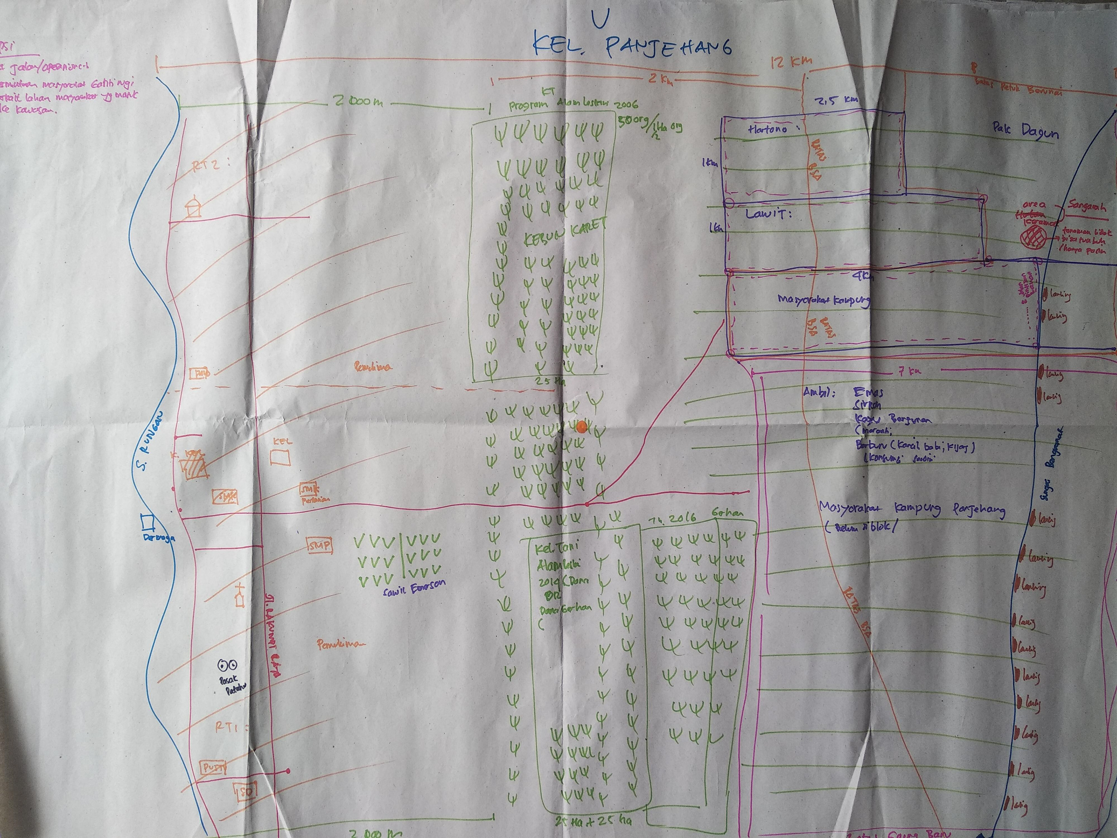
The Participatory Map of Panjehang. Notice the meticulous boundaries. This is not a map drawn to conquer space, but a map drawn to defend time. Photo by Hanggara Tala
Look closely at the participatory map of Panjehang we created. It is a chaotic, beautiful manifestation of human Dasein.
When a satellite looks down at this exact same coordinate, it sees a carbon sink—an objectified mass of biomass. Heidegger would call this seeing the forest as dihadirkan (Vorhandenheit). It describes the mode of objects when they are stripped of their practical utility and are instead observed simply as bare, theoretical entities or physical matter. It is a cold, calculating gaze that strips the world of its soul, turning it into a mere reserve of resources.
To impose a strict conservation prohibition on this landscape without understanding this temporal weight is to commit an act of ontological violence.
But on the hand-drawn map, the forest reveals itself as difungsikan (Zuhandenheit). The map is covered in markings for rubber plantations (kebun karet) and the sacred, haunted forest of Sangarah, a place so steeped in spiritual gravity that locals must leave markers so they do not lose their way.
It marks the spaces where they hunt (berburu), where they mine for gold and zircon in the Bengamat River, and where they harvest the specific timber needed to build their homes and their klotok boats.
To the people of Panjehang, the forest is not a concept; it is the very architecture of their survival. It is an extension of their bodies. You cannot simply draw a red line on a map and declare it a "no-go conservation zone" without amputating a part of their existence. Understanding requires the realization that a name can't fully describe it, and label wouldn't tie people. Words and maps are abstractions, but the hunger in a man's stomach is an absolute reality.
As I sat at my desk at night, reading through the compiled GPS coordinates, the social instrument data, looking at the photos, and the study report, I found myself returning to the 3 AM thought that had haunted me years after this expedition ended. Why do we map? Why do we photograph?
In my academic research on the ontology of photography, I realized that every time I press the shutter on my camera, I am creating a memorial. We photograph, and we map, because we are terrified of the tearing away of time. A photograph is an act of memoria—an intentional effort to take a reality that has been in the past and drag it into the future.
But a photograph is also a mirror, which humans foolishly stare back at. It is the true proof of human weakness at times over which they have no control. We map the forest, and we calculate its carbon because our modern achievement society is terrified of the ecological collapse it has brought upon itself. We are trying to freeze the forest in time, to save it from the apocalyptic machinery of our own industry.
But a photograph is also a mirror, which humans foolishly stare back at. It is the true proof of human weakness at times over which they have no control. We map the forest, and we calculate its carbon because our modern achievement society is terrified of the ecological collapse it has brought upon itself. We are trying to freeze the forest in time, to save it from the apocalyptic machinery of our own industry.
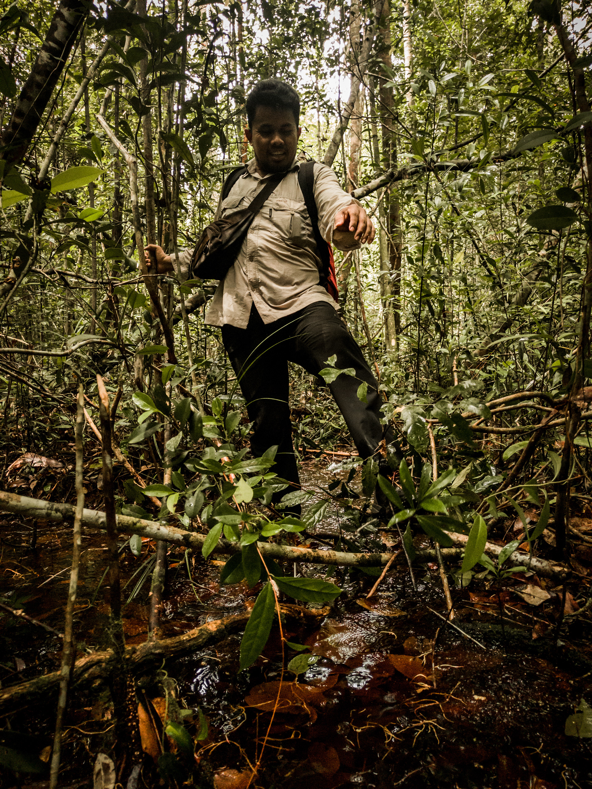
Uda Marta—one of the senior researchers in this study. In Mungku Baru Village, we broke through dense shrubs and tens of square kilometers of peat swamp to reach the boundaries of the concession area conserved in the Kahayan Conservation Project. Photo by Hanggara Tala.
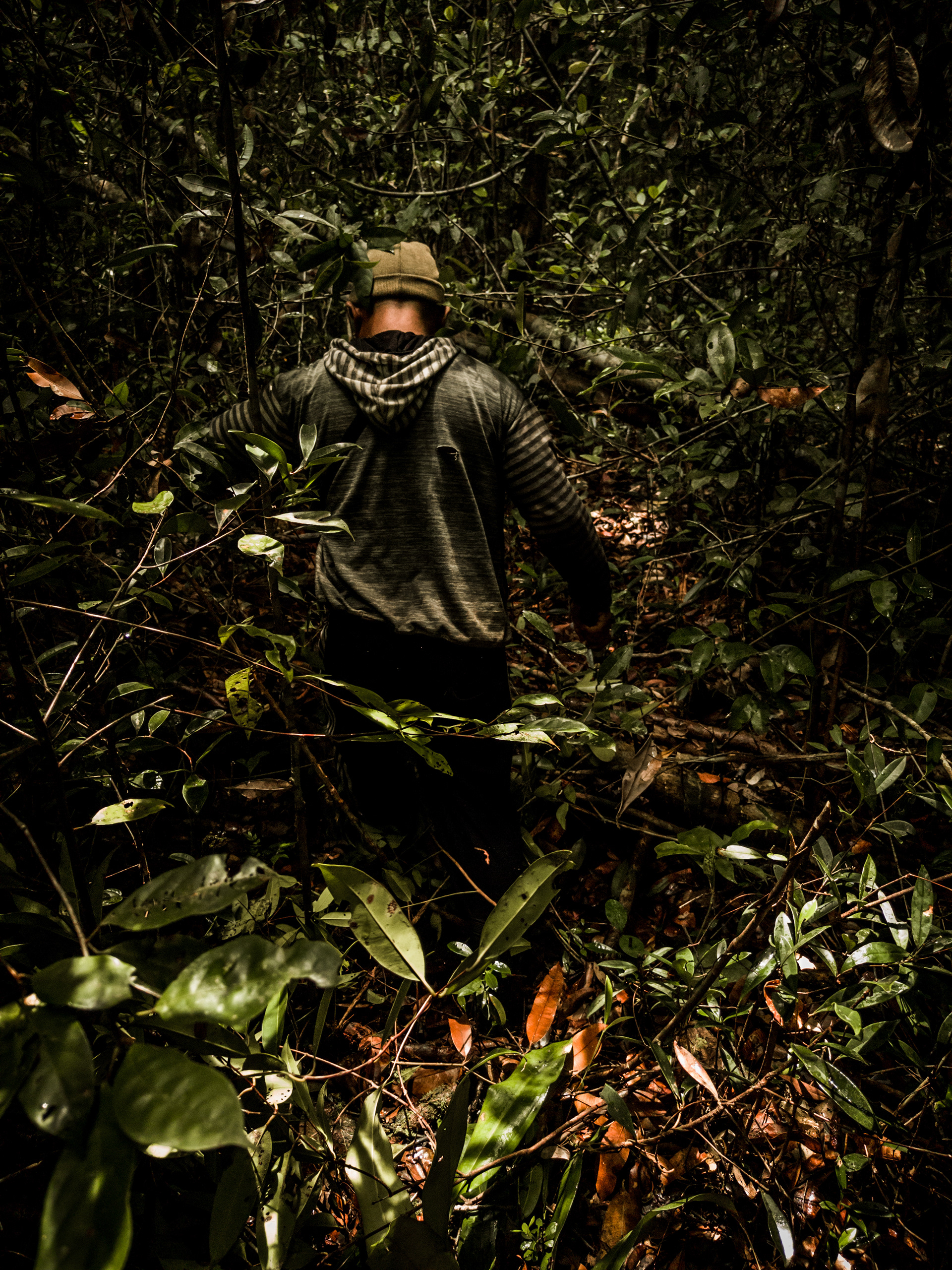
Accompanied by two local hunters, the study team traversed the forest to assess the natural conditions at one of the conservation area boundaries, eight kilometers from Mungku Baru village. Photo by Hangara Tala
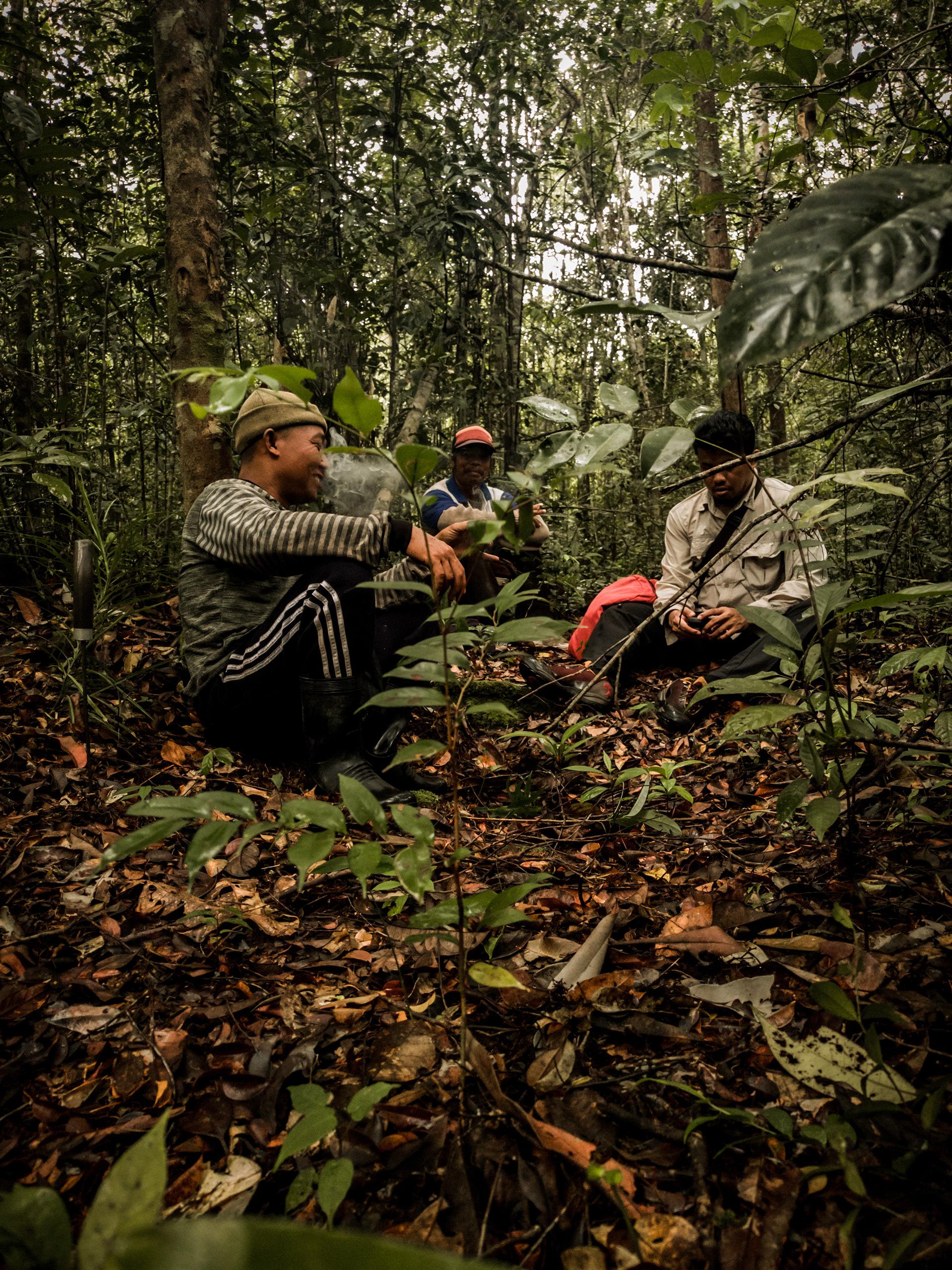
The journey from the boundary point to returning to the village took almost a full day and covered approximately 17 kilometers, as indicated by the tracking data. Photo by Hanggara Tala
Yet, what's a life without the abstraction of narrative to give its true meaning?. The Kahayan Conservation Project taught me that a carbon credit is entirely meaningless if it erases the human narrative. Our modern world treats success like it should cure us—like a pristine conservation map or a shiny ESG report can hush the scream of what we've seen. But you don’t solve the suffering of the world by immortalizing it on a GIS layout. You live through it. You breathe with it. Or it swallows you.
The maps we drew in Panjehang, Gaung Baru, Sei Gohong, and Mungku Baru were not just geographic tools. They were acts of poetry written in the dirt. We were arguing with the very concept of global sustainability, forcing it to look at the muddy, complicated, and desperately human reality of the peatlands. Take it lightly, you can see the light. Pulling it hardly, you hold its orbit, and we must hold the orbit of these communities with a gentle, contemplative grasp.
THREE
The Incandescence of Kahayan Landscape
Sometimes, when an expedition ends, it leaves a strange temporal dissonance. You pack your bags, load your cameras, and step off the klotok boat, leaving the heavy, humid air of the peat swamp behind. Within days, you are sitting in a sterile, air-conditioned room in Jakarta or Singapore, staring at an Excel spreadsheet. You are tasked with translating the Sandung shrines of Sei Gohong, the exhausted loggers of Pager, and the psychological trauma of Panjehang and Mungku Baru into quantifiable data points for a Climate, Community & Biodiversity (CCB) validation report.
This is the ultimate paradox of our modern achievement society. We believe that by digitizing the forest, we are saving it. We believe that if we can just calculate its carbon retention accurately enough, we can offset the hyperactive destruction of global capitalism. But thinking that entirely lacks any circuitous character degenerates into calculating. When we convert the Kahayan landscape into a carbon sink, we are stripping it of its scent. We are forcing it into the point-time of a digital clock, where time simply ticks away, empty and directionless, hurtling toward some arbitrary corporate deadline for "net-zero emissions".
But the forest does not operate on a digital clock. During my time in Central Kalimantan, I realized that the peatlands operate on what ancient Chinese philosophers called hsiang yin—an incense clock. As an incense clock burns, time does not flow or trickle away into nothingness. Instead, the scent of the incense fills the room, turning time into space, giving it a profound duration. The ash that remains does not disintegrate; it holds the shape of the seal, preserving the memory of the fire.
The Kahayan landscape is an incense clock. The towering Red Belawan trees, shedding their bark slowly; the Sangarah haunted forests where locals leave markers so they do not lose their way; the traditional Ayunku land claims carved through the brush by generations of Dayak farmers—these are the ashes of time, holding their shape against the wind. When we arrived to map these boundaries, we were not mapping empty geography. We were mapping the fragrant, lingering ash of their existence. To impose a strict conservation prohibition on this landscape without understanding this temporal weight is to commit an act of ontological violence.
In my academic research, I spent years dissecting the phenomenology of Martin Heidegger and the ontology of photography. The fundamental question that haunted me then, and which haunted me every time I remembered my time raising my Sony camera in the forests of Bukit Sua or Gaung Baru, was simple: Why do we photograph?.
Our modern world is terrified of the tearing away of time. I've mapped the forest and photographed its inhabitants because I'm terrified that the accelerating machinery of our own industry will devour them. Every time I pressed the shutter, capturing the faces of Pak Simpel, Pak Asmin, or the zircon miners on the Takaras River, I was creating a memorial. And my photograph is an act of memoria—my own intentional effort to take a reality that has been and drag it forcefully into the future. The mere representation I intentionally carry on every time at the point I left that landscape.
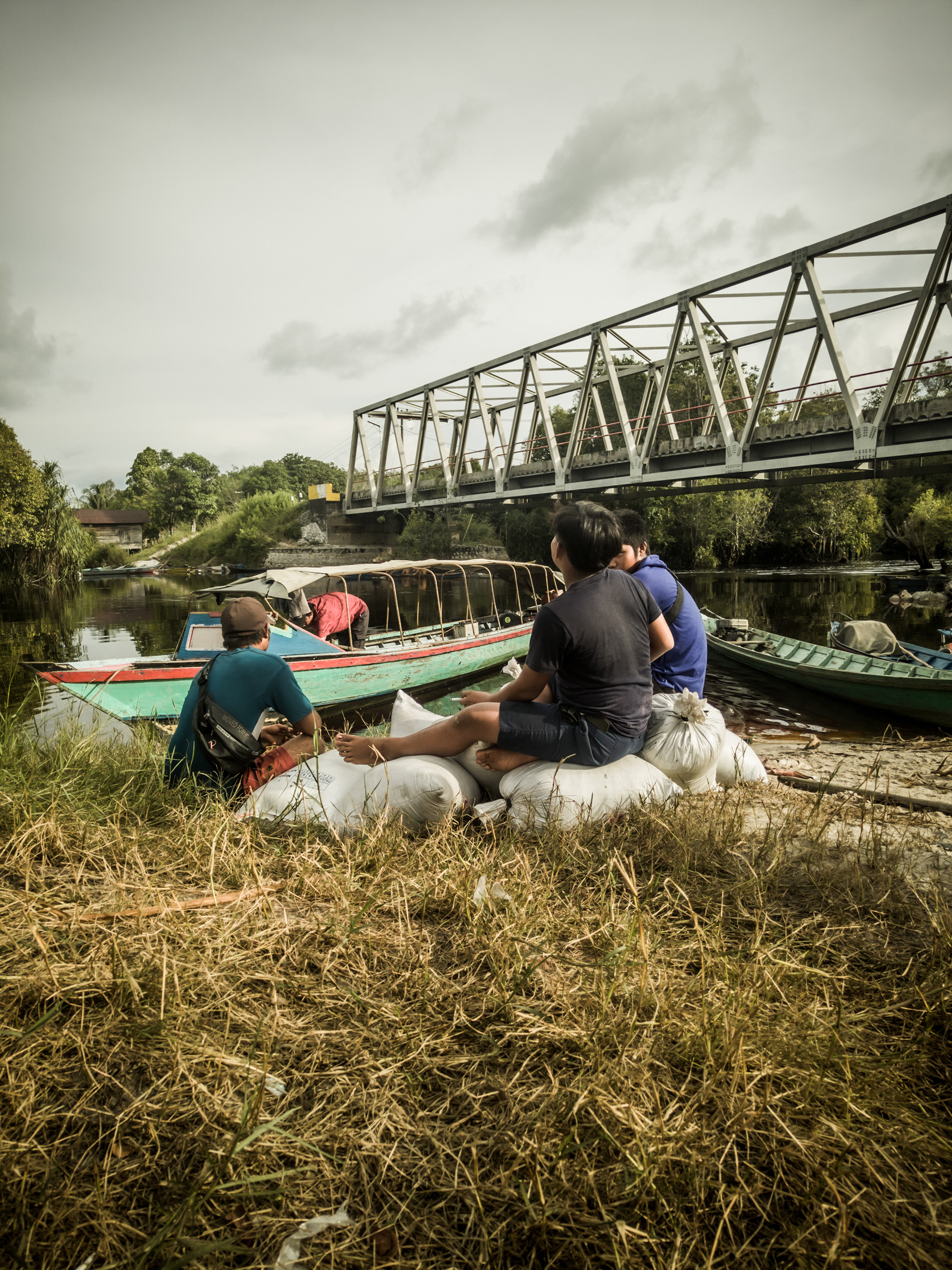
Children in Sei Gohong Village help their parents carry sacks of zircon sand extracted from the floating lanting. Photo by Hangara Tala
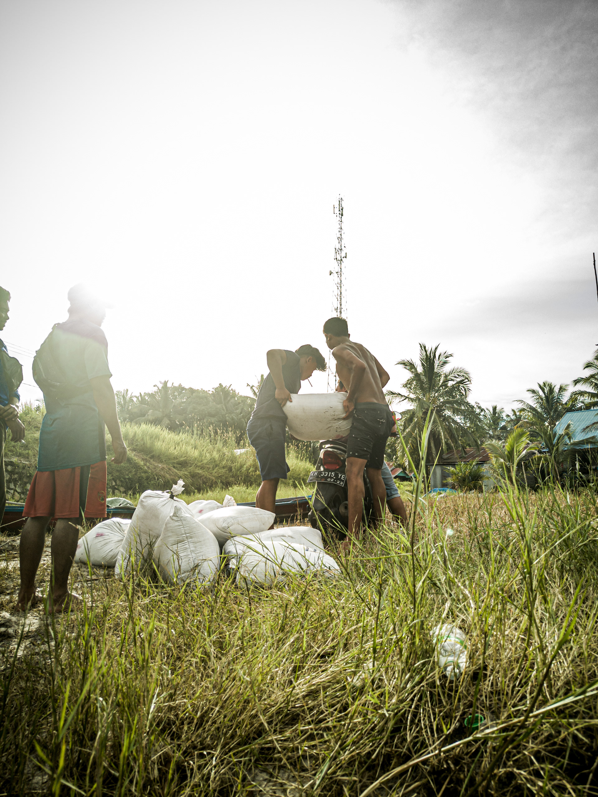
Each bag of zircon sand can weigh 80-100 kg. After being carried from the floating boat to the nearest village pier or riverbank, it is then transported to the nearest weighing station, if there is one in the village. Photo by Hanngara Tala
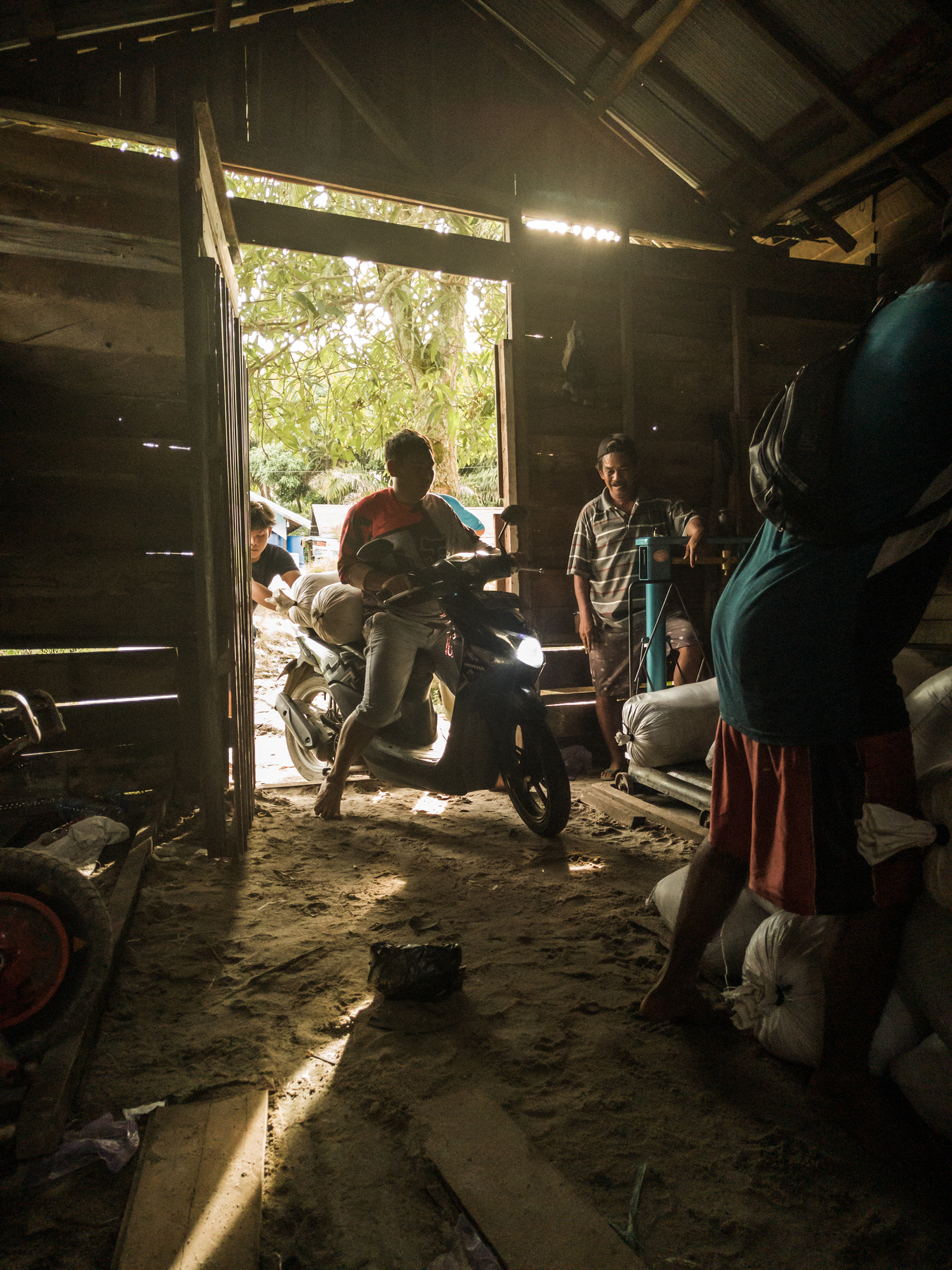
And one of the weighing places is in Sei Gohong village, so several sand miners from other villages also often transport their mining products here before selling them to collectors or buyers. Photo by Hanggara Tala
But we must be careful not to confuse the representation with reality. A photograph is a mirror, which humans foolishly stare back at. A CCB document, a GIS map, or a beautifully color-graded documentary film cannot, on its own, save a forest. Fundamental reality is non-reproducible, and whatever can be reproduced is merely a representation. The global sustainability market treats a verified High Conservation Value (HCV) report as if it can hush the scream of the extreme poverty we witnessed in the logging pondokan. But we don’t solve the suffering of the world by immortalizing it on a map, a framework, a scientific standard, or in a photograph. You need to live through it. You need to breathe with it.
If we only see the forest as something present-at-hand (dihadirkan)—an object to be conserved for the sake of global carbon metrics—I think we would fail to face the reality. Instead, we must see the forest as ready-to-hand (difungsikan) as if we are the people who rely on it to survive. The people of Panjehang and Mungku Baru, carrying the deep scars of past corporate betrayals, do not care about global emission targets. They care about whether they will still be allowed to gather wood to repair their boats. They care about whether the Ayunku lands of their ancestors will be respected. We cannot conserve a landscape by amputating the human narrative from it.
I believe that creation and destruction are one and the same, and all new ideas destroy what we previously believed. The Kahayan Conservation Project was not just a technical exercise—at least for me—it was an exercise in destruction. We had to destroy the arrogant, preconceived notions of modern conservation to make room for the messy, imperfect, and deeply human reality of the peatlands. We had to learn that rigid plans fail against reality. To navigate the overlapping conflicts, the historical trauma, and the desperate economic realities of Central Kalimantan, we had to become formless. We had to surrender our agendas. We had to sit on the wooden floors of village homes, drink the brownish, peat-filtered swamp water, and simply listen.
This is the profound releasement that our hyperactive world so desperately needs. In the face of a global climate crisis, we do not need more frantic, accelerated corporate solutions that treat local communities as obstacles. We need a vita contemplativa—a long, slow gaze that goes easy on things, letting them be in their own space and radiance. The participatory maps we drew with the elders of Kanarakan and Petuk Bukit were our destruction. They were a silent rebellion against the point-time of the achievement society. They were a declaration that these forests are not empty spaces waiting to be monetized, but living ecosystems breathing with the scent of time.
As I write this now, reflecting on the heavy, muddy trails, the Belawan trees, and the quiet dignity of the Dayak communities, I am reminded of why I chose this path of documentary filmmaking and field research.
The hidden pattern of philosophical learning is simple: the more you think, the more you retain. The brain isn’t a container that stores data; it’s a machine that reconstructs meaning, and it only activates that power when it feels the weight of effort. We must be willing to feel the weight of the world's suffering if we are ever to reconstruct its meaning. We must be willing to look foolish, to abandon our corporate jargon, and to step into the swamp.
The hidden pattern of philosophical learning is simple: the more you think, the more you retain. The brain isn’t a container that stores data; it’s a machine that reconstructs meaning, and it only activates that power when it feels the weight of effort. We must be willing to feel the weight of the world's suffering if we are ever to reconstruct its meaning. We must be willing to look foolish, to abandon our corporate jargon, and to step into the swamp.
Survival is hard, but it should not make us couldn’t feel the warmth of the rain. We must return the warm feeling of the rain to the people who live at the edges of our global supply chains. We must ensure that their voices, their trauma, and their perception of time are not erased by the very systems attempting to save them. The earth above Kalimantan may eventually be monetized, but the earth below will always belong to those who bleed, sweat, and survive upon it. Let us walk slowly alongside them, let us listen to the rustle of the Belawan bark, let us listen to understand their past, and let our compassion become the compass.
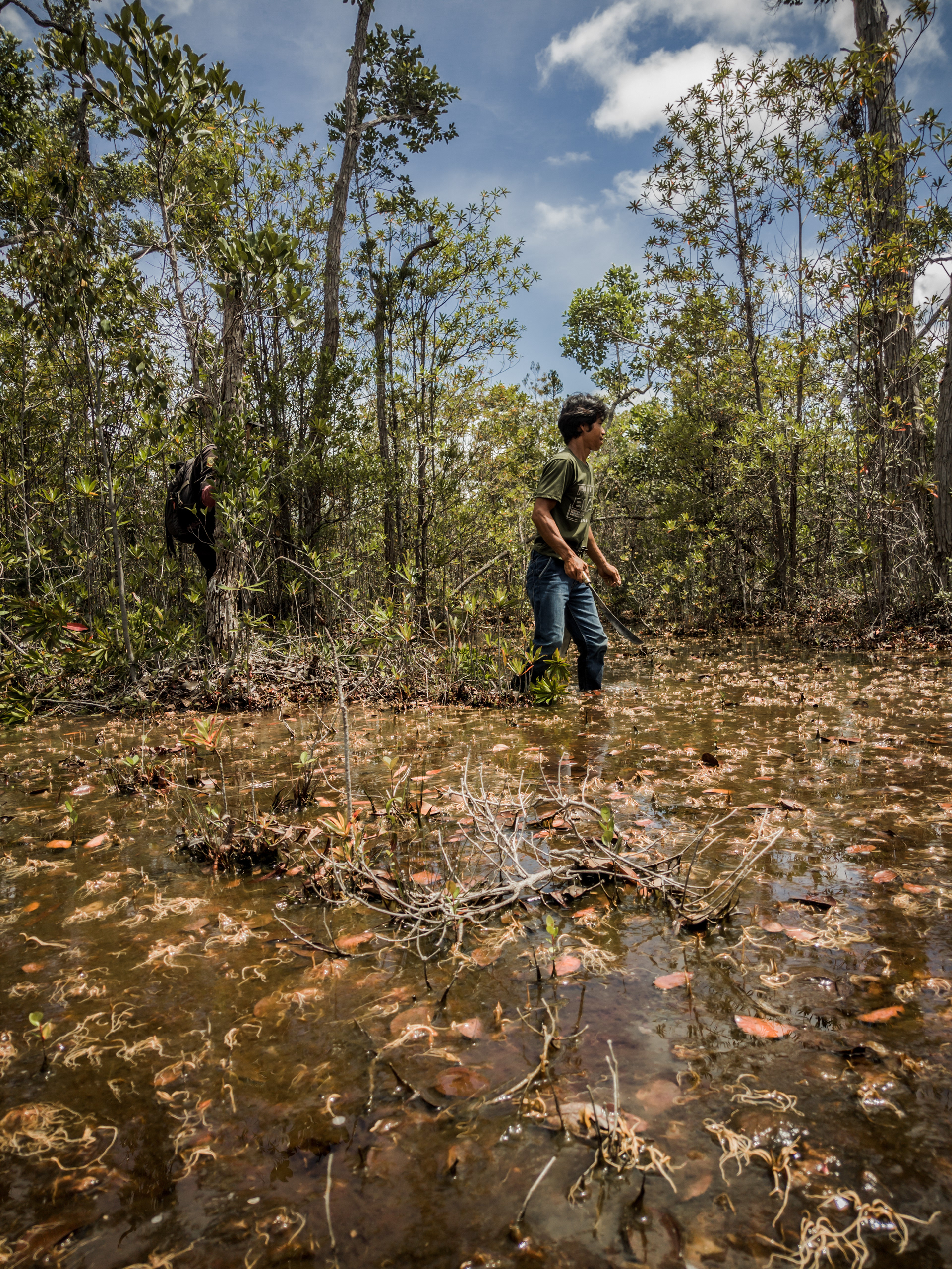
Even in this swampy peatland, in the land that is constantly drenched by rain, there is still a warmth that must be maintained. Photo by Hanggara Tala